
size it up geography
Size It Up Geography: Comparing Countries, Lakes, and Wonders
A complete Size It Up geography guide covering countries, lakes, cities, natural wonders, scoring, strategies, and estimation techniques for the Geography mode.
Size It Up Geography: Comparing Countries, Lakes, and Wonders
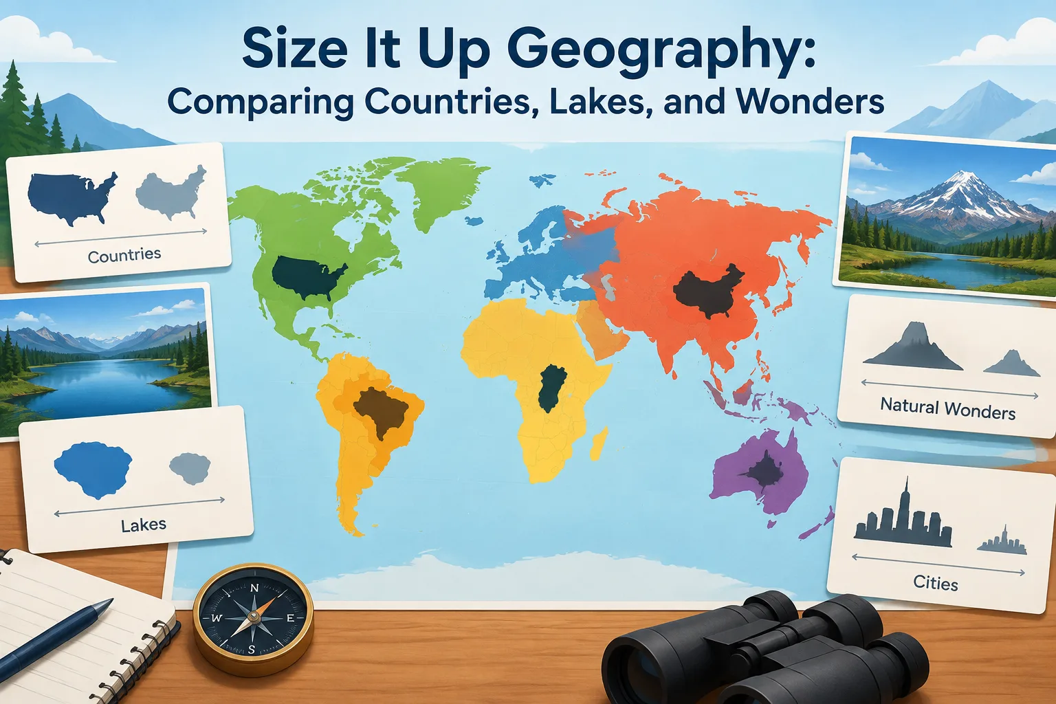
Size It Up geography is a mode of the Size It Up game that turns real-world locations into a visual size comparison challenge. Instead of estimating everyday objects, players compare places such as countries, states, lakes, cities, and natural wonders by resizing silhouettes until they match the correct scale. The goal is to build geographic intuition and earn points through accurate size estimates.
This guide explains how Size It Up geography works, what makes geography comparisons difficult, and how players can improve their guesses. It also covers the difference between verified game mechanics and general strategy ideas that can help with estimation.
What is Size It Up geography mode?
Size It Up geography mode is a location-based comparison mode where players estimate the relative size of geographic features. The official Geography variant describes the experience as comparing countries, states, lakes, cities, and natural wonders using visual scale challenges. Players adjust a shape against a known reference and try to match the real-world dimensions.
The mode follows the same general scoring structure as other Size It Up comparisons: players complete five comparisons, with each comparison offering up to 100 points for a possible total score of 500 points. The challenge is not memorizing every measurement but developing a reliable sense of scale.
For players learning the basic rules first, the Size It Up basics guide explains the wider game format, while the how to play guide covers the resize-and-lock-in process.
How does the Size It Up geography game work?
The Size It Up geography game works by presenting a geographic shape and asking players to estimate its size compared with a reference. You resize the displayed silhouette, make a final selection, and receive a score based on how close your estimate is.
The important skill is translating a flat visual shape into a real measurement. A country outline may look small on a screen but represent thousands of kilometers of distance and millions of square kilometers of area. Lakes and natural wonders create different challenges because their shapes may be long, narrow, irregular, or curved.
A typical round involves:
- Identifying the geographic feature.
- Considering whether the comparison is mainly about area, length, or another dimension.
- Using familiar places as mental references.
- Adjusting the silhouette carefully before locking in the answer.
- Reviewing the score and learning from the result.
Why are countries difficult to compare in Size It Up?
Countries are difficult to compare because maps can change how large places appear. A country’s visual size depends on its actual dimensions and the way it is represented on a map. Players often rely on remembered map images, but those images can create inaccurate impressions.
One common issue is confusing apparent size with real area. Some map projections make regions near the poles appear larger than they are relative to areas closer to the equator. This means a player should be cautious about judging a country only from a familiar classroom map.
A better approach is to think in multiple ways:
- Area: How much land does the country cover?
- Length: How far does it stretch from one point to another?
- Shape: Is it compact, elongated, or fragmented?
- Familiar comparison: Which known country or region feels similar in scale?
The same principle applies to other geographic objects. A long lake may have a smaller area than expected, while a compact lake may cover a surprisingly large surface.
What strategies help with Size It Up countries?
Size It Up countries comparisons reward broad geographic knowledge, but players do not need to memorize every measurement. Practical estimation methods can make guesses more consistent.
Use anchor locations
Anchor locations are familiar examples that help create a mental scale. For example, a player may remember that a certain large country occupies a significant portion of a continent, while a smaller country may fit within a much narrower range.
The goal is not to recall exact numbers every time. Instead, use known references to avoid extreme mistakes.
Separate area from length
A frequent mistake is assuming a long country must have a huge area. Geography contains many narrow regions that stretch across great distances without covering as much land as compact countries of similar length.
When comparing shapes, ask whether the challenge is testing total area or a particular dimension. This distinction can prevent large scoring losses.
Watch for unusual shapes
Irregular borders make estimation harder. Islands, archipelagos, and countries with narrow extensions can look misleading. Focus on the main mass of the shape rather than one unusual section.
Players interested in reviewing previous patterns can use the Size It Up archive analysis section to explore how different categories create different estimation challenges.
How can players improve at geography size estimation?
Improving at geography size estimation comes from repeated practice and reviewing mistakes. Every incorrect guess provides information about personal bias.
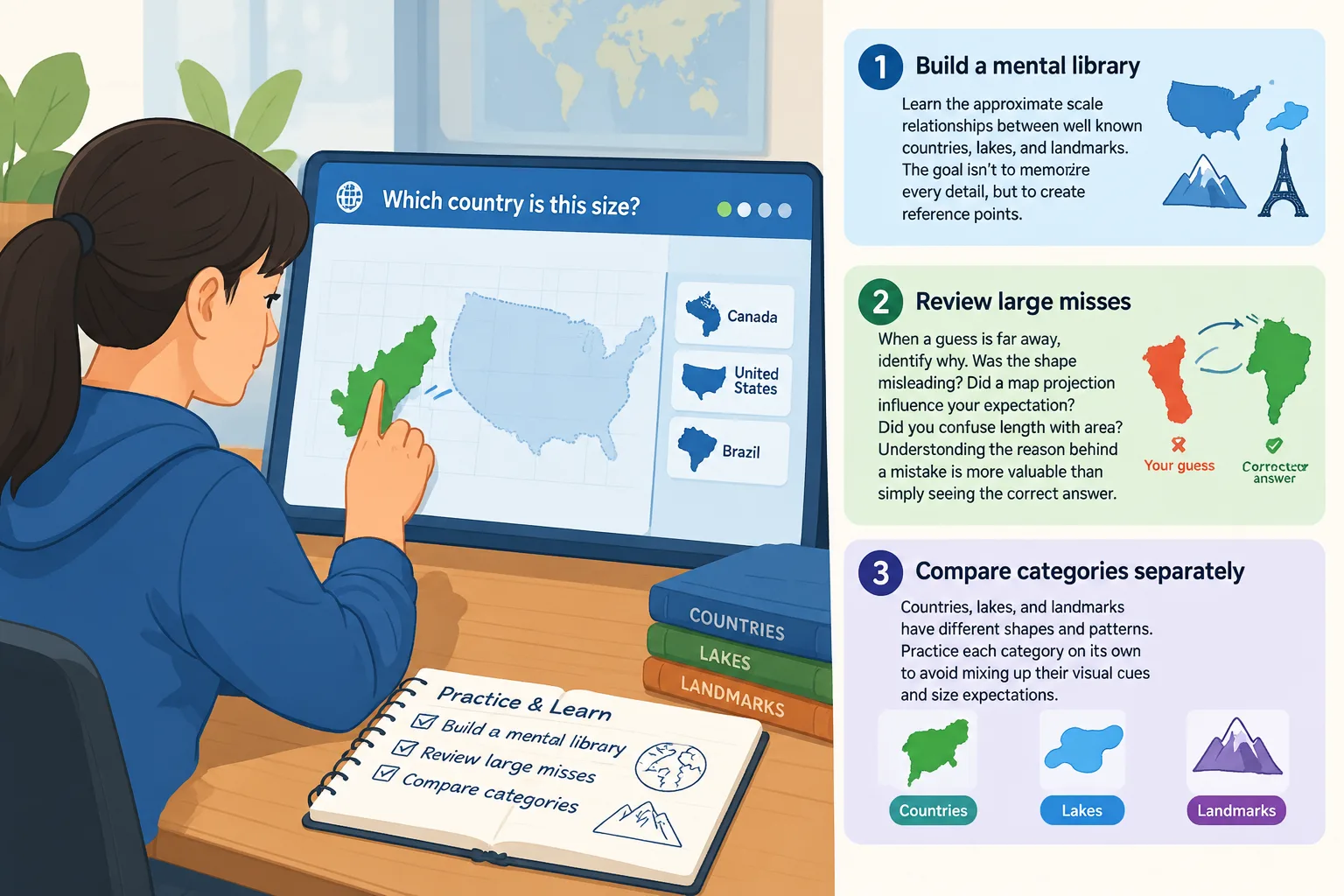
A useful practice routine includes:
Build a mental library of major examples
Learn the approximate scale relationships between well-known countries, lakes, and landmarks. The purpose is not to memorize a giant database but to create reference points.
Review large misses
When a guess is far away, identify why. Was the shape misleading? Did a map projection influence your expectation? Did you confuse length with area? Understanding the reason behind a mistake is more valuable than simply seeing the correct answer.
Compare categories separately
Countries, lakes, and natural wonders require different instincts. A player who is strong at estimating country areas may still struggle with narrow lakes or long geographic features.
The Size It Up variants guide provides more context on how different modes change the type of comparison players need to make.
What makes geography size games educational?
Geography size games combine visual reasoning, memory, and real-world knowledge. They encourage players to understand relationships between places rather than only memorizing isolated facts.
Size comparison activities can reveal surprising facts about the world. A lake may span several regions, a country may be larger than expected, or a natural wonder may have dimensions that are difficult to judge from photographs.
These games are especially useful because they turn abstract measurements into visual problems. Instead of reading a number such as an area measurement, players develop an intuitive understanding of scale.
Verified mechanics versus community strategy ideas
The confirmed mechanics of Size It Up geography include the visual comparison format, geographic categories, five comparisons per round, and scoring up to 500 total points. These details come from the official variant information.
Other advice in this guide, such as using anchor locations or separating area from length, should be viewed as player strategy rather than official game rules. Different players may find different methods effective.
For daily play resources and related game information, the daily answers section can help players explore additional Size It Up content.
Frequently Asked Questions about Size It Up geography
What is Size It Up geography?
Size It Up geography is a game mode focused on comparing the sizes of geographic features such as countries, states, lakes, cities, and natural wonders. Players resize silhouettes to estimate real-world scale and receive points based on accuracy.
How does Size It Up geography mode scoring work?
Size It Up geography mode uses the same five-comparison scoring format described for the variant, with up to 100 points available for each comparison and a maximum score of 500 points.
Are Size It Up countries comparisons based on exact area?
Size It Up countries comparisons require players to estimate geographic scale visually. The challenge may involve understanding overall shape and size relationships rather than simply recalling an exact measurement.
Why do maps make geography size games harder?
Maps can make some regions appear larger or smaller depending on the projection used. Players should avoid relying only on visual impressions from a familiar map and should consider real-world scale relationships.
Can I get better at Size It Up geography without memorizing every country size?
Yes. Players can improve by practicing comparisons, learning anchor examples, reviewing mistakes, and developing a stronger sense of area and distance relationships.
Is Size It Up geography the same as the regular Size It Up game?
It uses the same general comparison and scoring approach, but the Geography mode changes the subject matter from everyday objects or other categories to places and geographic features.
Final tips for better geography guesses
The best Size It Up geography players combine knowledge with estimation. Exact recall helps, but flexible thinking is often more important. Think about shape, area, distance, and familiar references before committing to a guess.
Geography is full of scale surprises, and this mode turns those surprises into a daily challenge. By practicing regularly and learning from each comparison, players can build stronger geographic intuition while improving their scores.